
OM MANI PADME HUM |
||
ANNAPURNA CIRCUIT BASECAMP TREKKING Pokhara - Tatopani - Kagbeni - Jomson - Muktinath Śrī Muktināth Thīrthayātrī Sant Sevāśram |
||
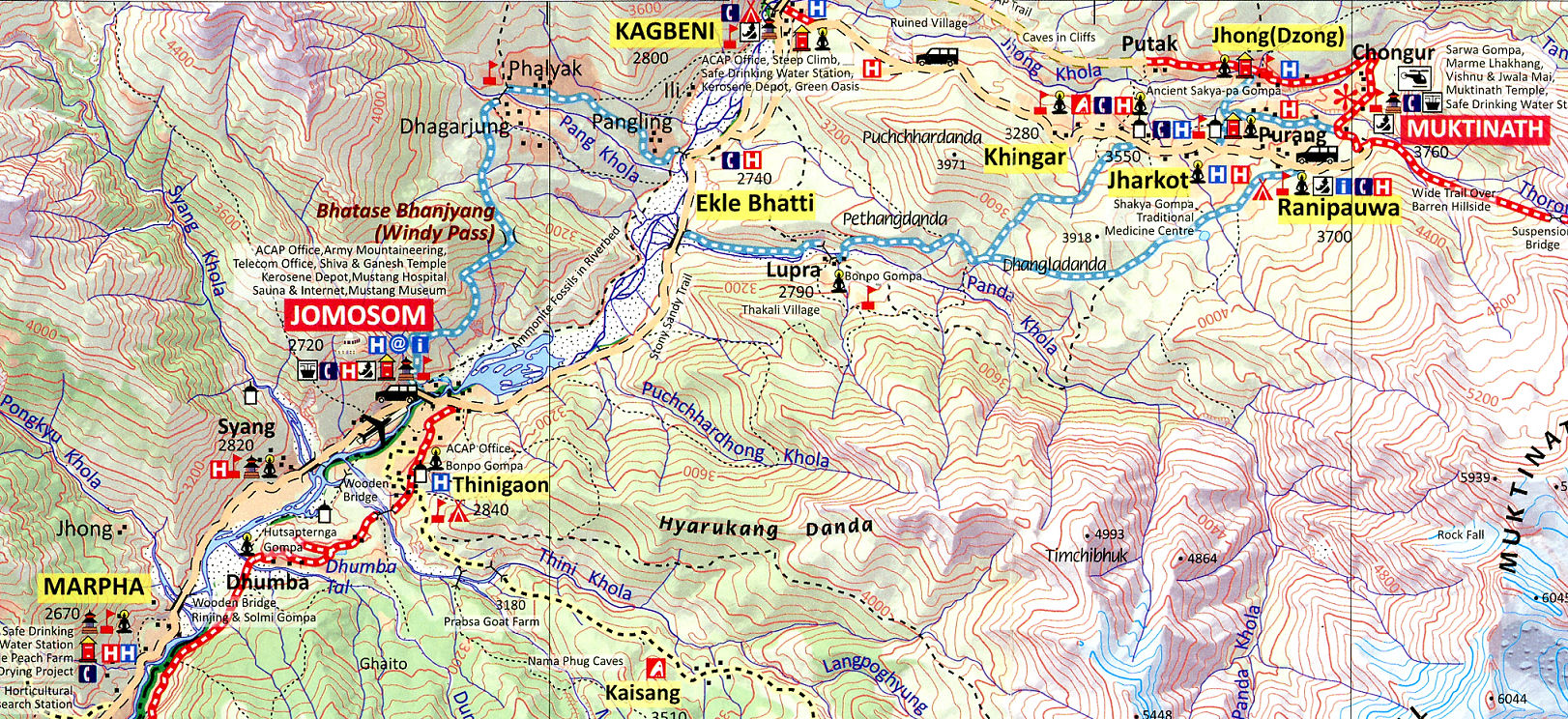
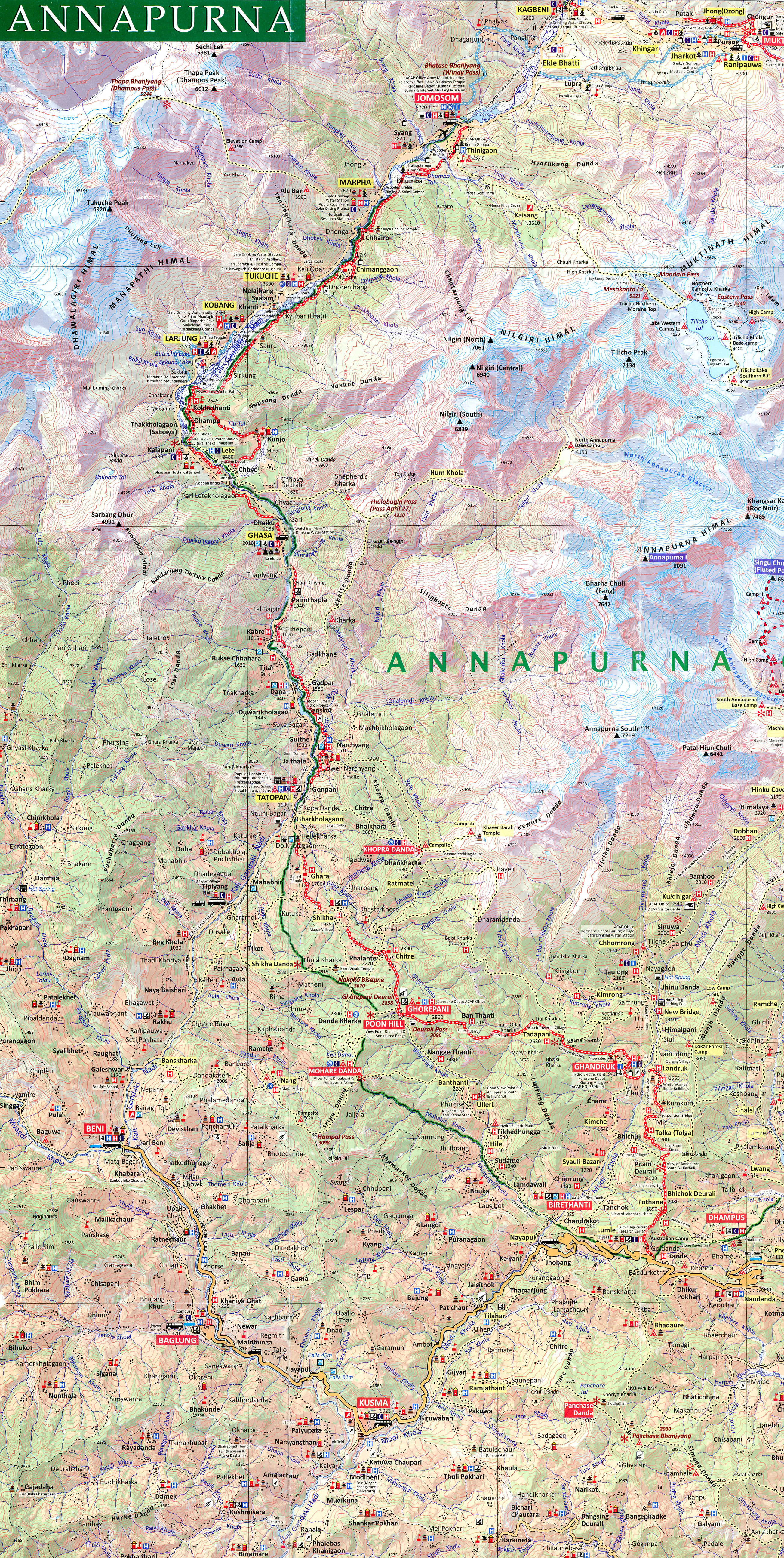
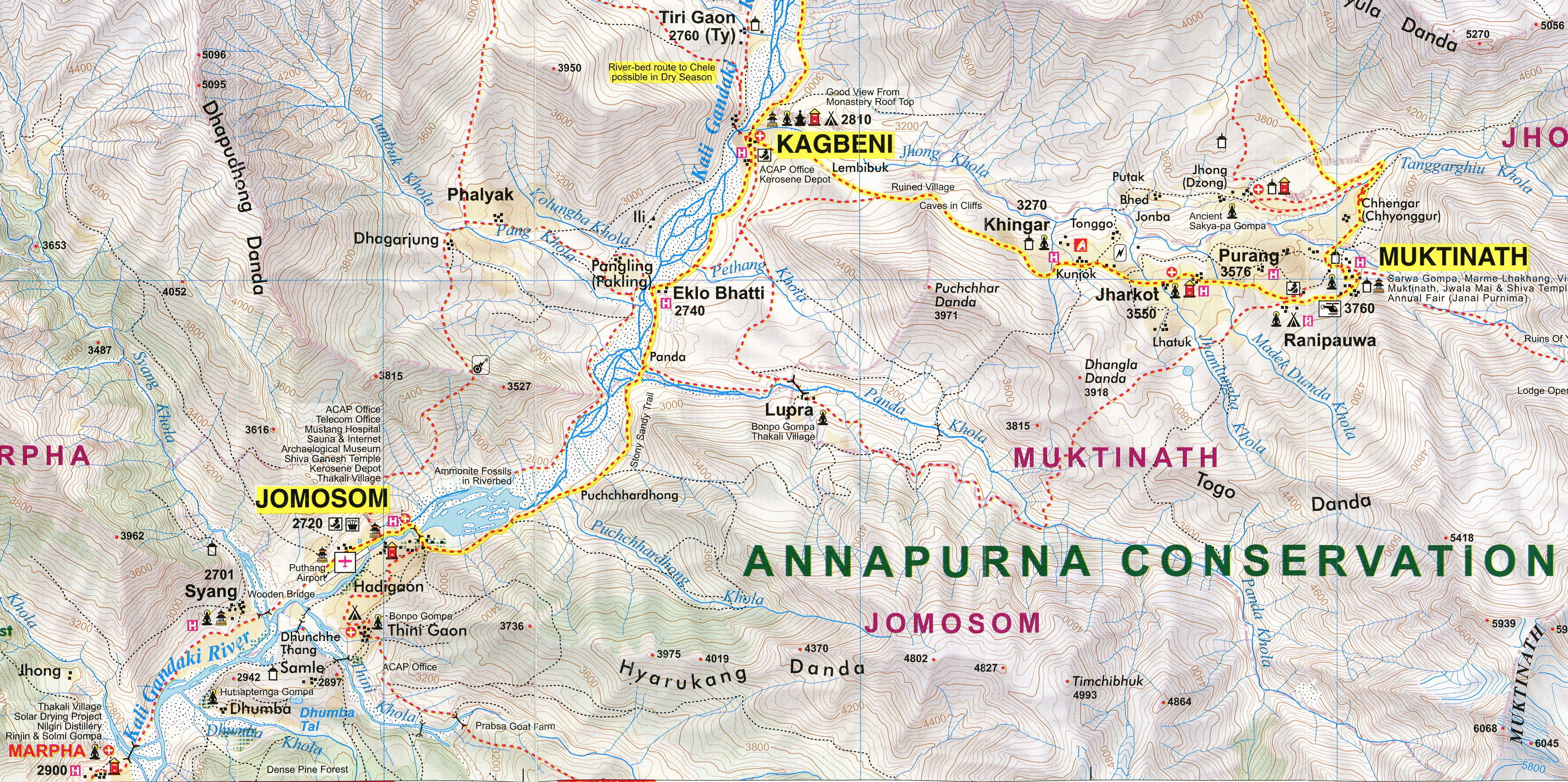
Trekking Map of Muktinath and Annapurna Circuit (klick to enlarge)
Here is a map of the Great Himalaya Trail as it passes along the Annapurna Circuit route. The Annapurna Circuit is a popular name for a trek within the Annapurna mountain range of central Nepal. The map shows the classic trail to Muktinath via Kagbeni, Jomsom, Marpha and Tukuche. You can view the trekking trail with all details.
Situated at an altitude of 3,710 meters (12,172 feet) at the base of the Thorong La mountain pass in the Mustang district, Muktinath is a highly venerated sacred place for both Hindus and Buddhists. The total length of the route varies between 160–230 km. Muktinath is the ideal altitude and distance for a well-paced, sacred yatra. The flight to Jomson is thrilling. The trek to KagBeni and Muktinath are enchanting. Annapurna Circuit trek is a classic trekking around the world's tenth highest mountain.
 |
 |
|

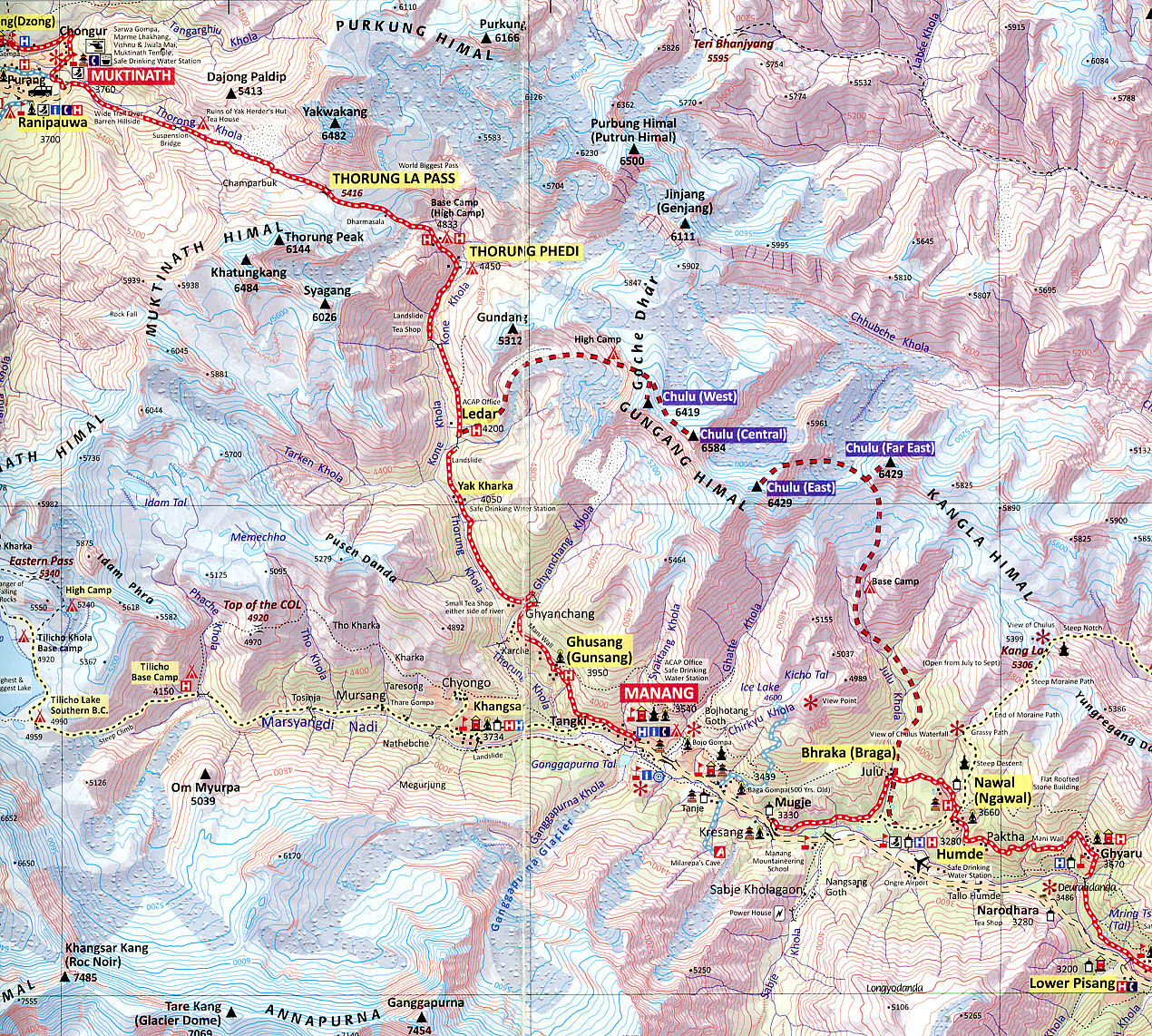
Manang - Thorong La mountain pass
The highlight of the Annapurna Circuit route, however, is crossing Thorung La Pass, which sits at an altitude of 5,416 meters (17,769 feet) and connects the village of Manang in the east with the famous temple of Muktinath in Mustang in the west. The pass was originally used by locals as a trade route, herding agricultural products on yaks and donkeys.
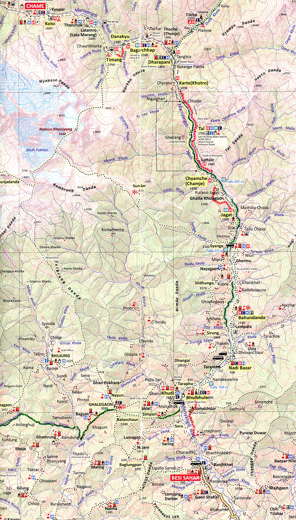
The trekking to complete the Annapurna Circuit starts in the town of Besi Sahar, approximately a six-hour drive from the capital Kathmandu or a three-hour drive from Pokhara, a popular tourist destination. Many tourists still choose to walk from Besi Sahar and complete the trek in about three weeks, which takes them through small villages where locals provide food and accommodation. But in the past decade, an unpaved road runs to Chame, the headquarters of Manang district, which gives many trekkers the ability to rent jeeps and cut short the trek by at least a few days.
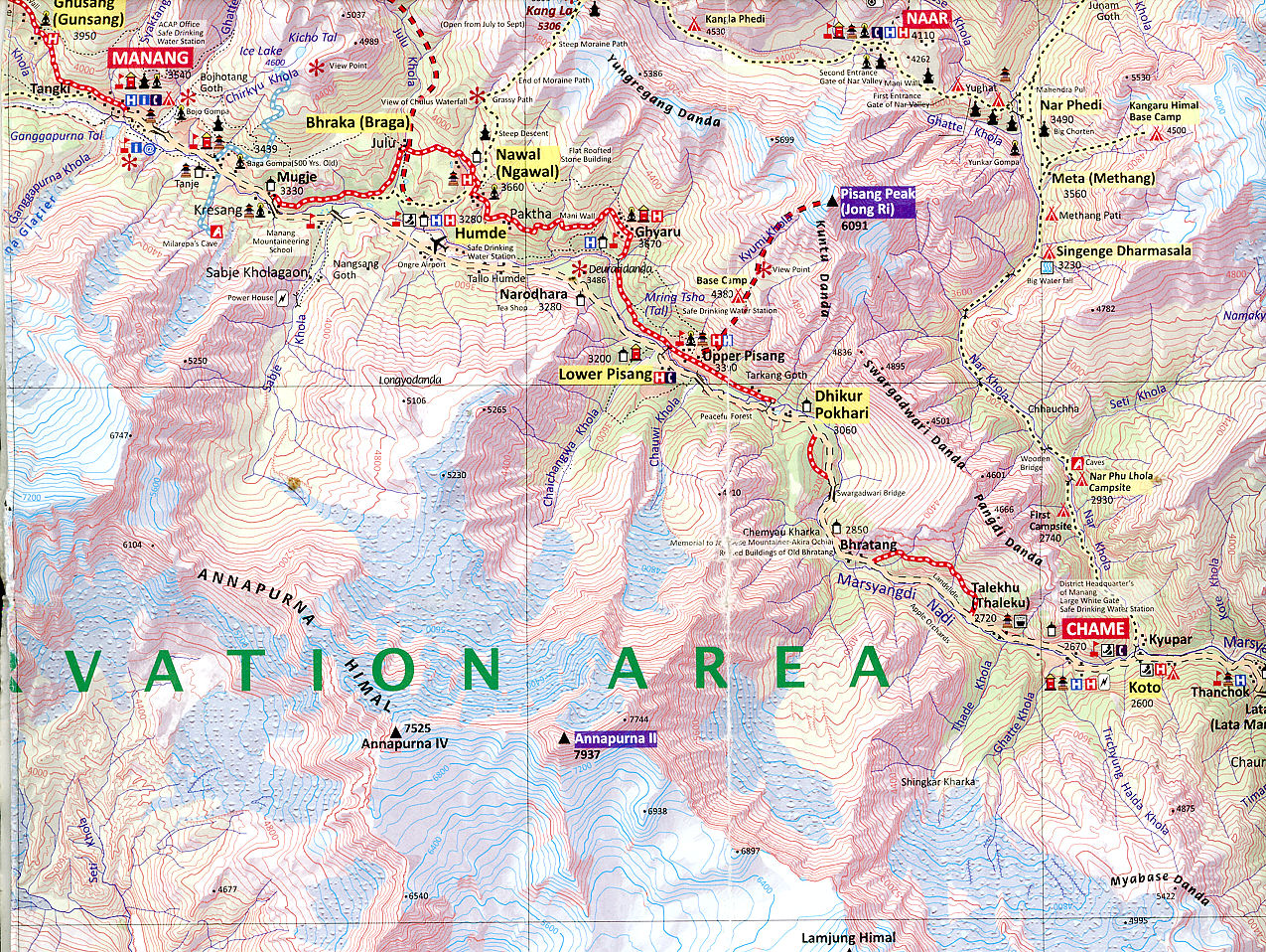
The circuit goes through Manang, from where trekkers can choose to hike to the Tilicho lake, one of the highest lakes in the world, sitting at an altitude of 4,919 meters (16,138 feet).
Manang to Muktinath via Thorong La Pass |
Besi Sahar to Chame via Dharapani Besi Sahar to Chame via Dharapani |
|
Once across the Thorong La Pass, trekkers descend to Muktinath and then to Jomsom, from where they can catch a flight to Pokhara or continue to walk to complete the full circuit.
In recent years, the circuit has lost its original charm partly due to the construction of a road that frequently leaves trekkers covered in dust from passing vehicles. Although tourists continue to flock to the region, partly to be able to cross the Thorung La Pass, newer trekking destinations in Upper Mustang, Nar Phu valley, Manaslu and Tsum valley are slowly gaining interest as more natural destinations for adventure.